


Location
Benin
Typology
Landscaped wall
Date
2023
Customer
Republic of Benin
Solution:
Atalus 120

Atalus 120
Learn more

max height
Up to 26 meters
UNIT WEIGHT
120kg
UNIT/M2
~3.9
VOLUME OF TOPSOIL
~250L / m²
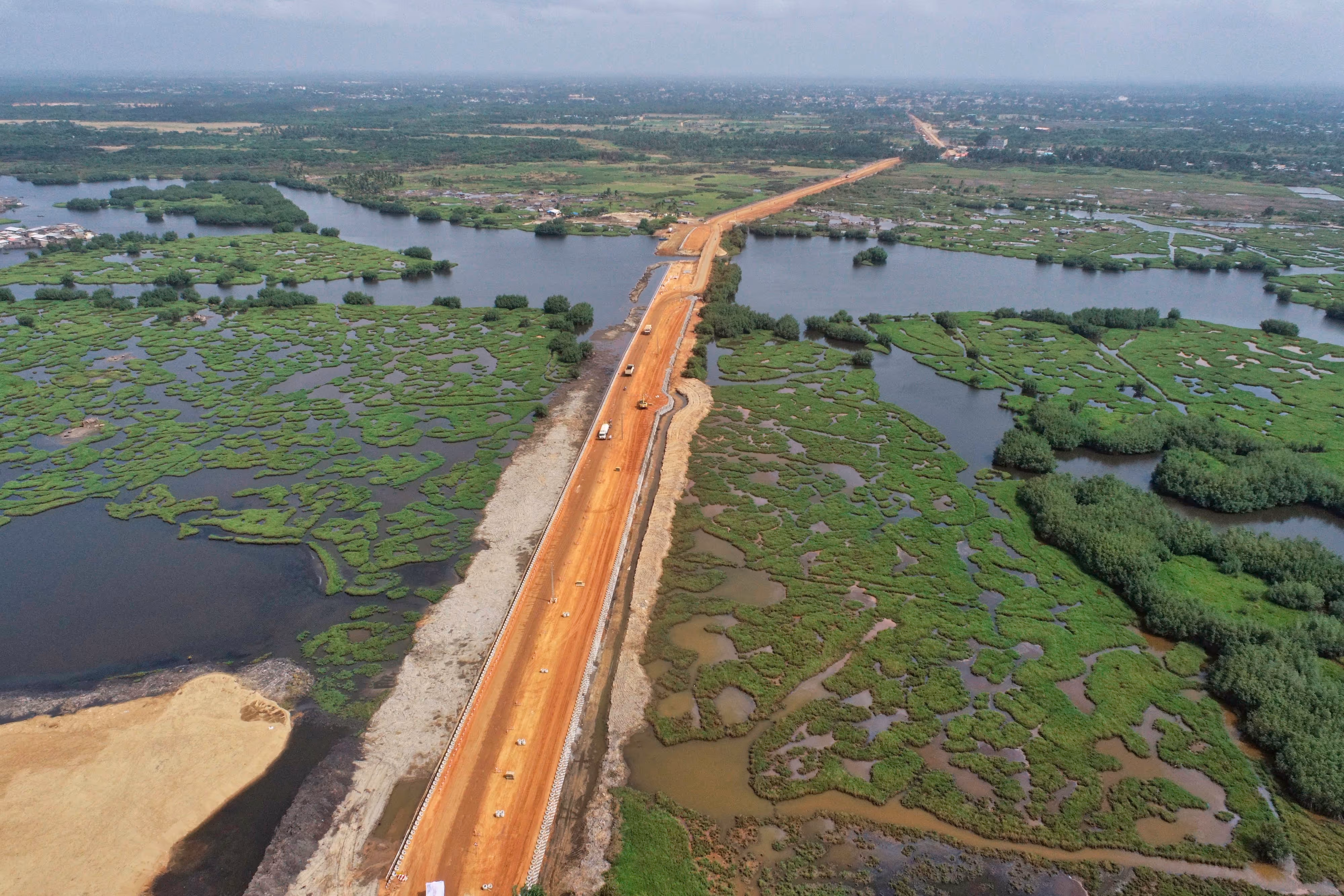
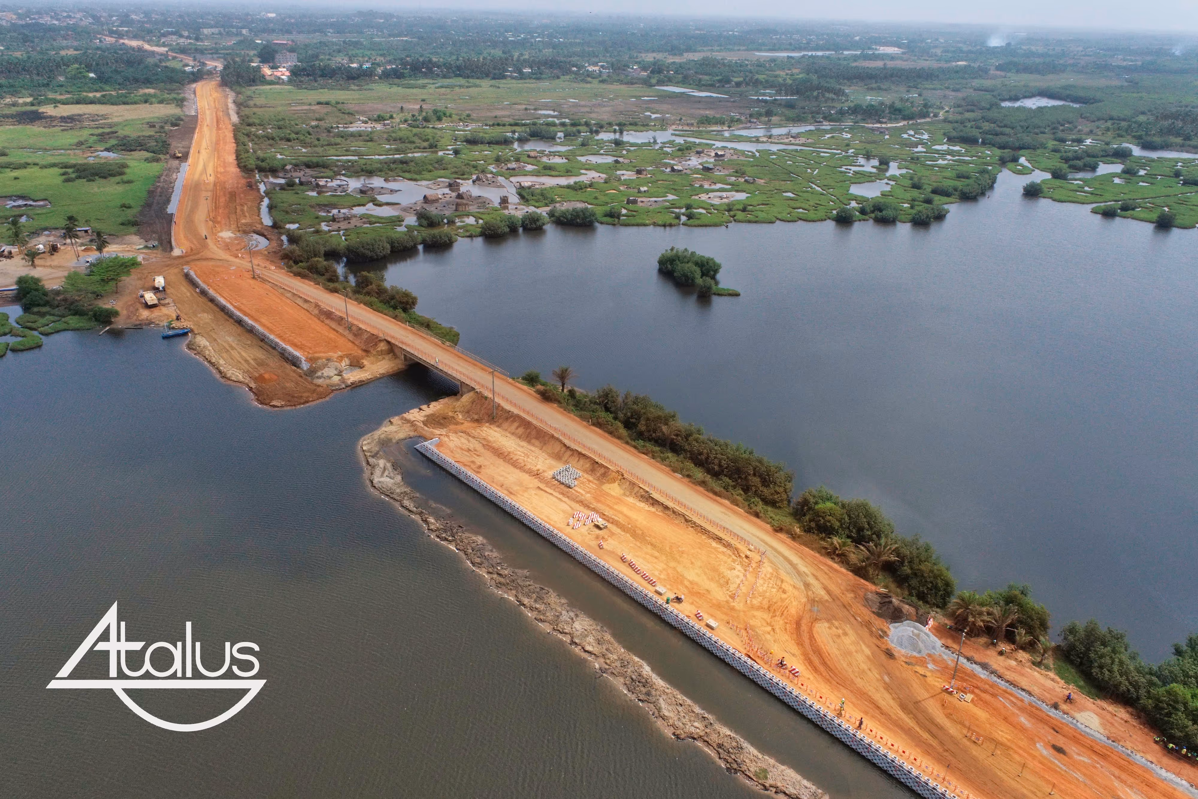
Benin: Fishing Route (Phase II)/Slave Route (Ouidah)
TO Ouidah (Benin), the construction site of the Fisheries Route — Phase II includes the realization of the Slave Route and its ramps, with a major challenge: to secure and maintain a coastal axis subject to the constraints of the lagoon and rainy seasons.
Background & purpose
The program entrusted to SOGEA SATOM focuses on development and paving:
- Of the section Adounko — Gate of No Return — Bouche du Roy (35.80 km)
- Braces Adounko — Cococodji (4.73 km), Avlékété, Pahou (5.22 km) and Gate of No Return — RNIE Ouidah (8.00 km)
- That is a total linear of approximately 53.75 km.
Technical challenges
- Achieve a retaining wall in a wetland, with part of the work that can be submerged up to 1.50 m During the rainy season
- Carry out the earthworks (purges under Atalus and under the pavement) and the assembly of the wall with a clear objective: Put the project out of water (+1.5 m) before the rains arrive
- Implement a specific pose partly submerged, with elements positioned so as to touch each other on the area concerned
Solutions implemented
- Pose of the first Atalus 120 for the retaining wall of the Slave Route
- Site organization oriented “out of water”: earthworks, purging, assembly and backfilling according to the construction phases
- Geotechnical reinforcement (depending on the project) with geotextiles provided by SOLMAX
Result
The “out of water” objective has been achieved: the structure is secured against the rains, and the Slave Route Start to change face, demonstrating the relevance of an ATALUS modular support in a tropical and hydraulically constrained environment.
Speakers
- Project owner: Republic of Benin
- Project manager/Design office: INGEROP
- Business: SOGEA SATOM
- Reinforcing geotextiles: SOLMAX
Discover our retaining wall projects

Licensees in +20 countries around the world
LIST OF COUNTRIES


Lorem Lipsum Pain Sits Amet, Conecteur adipiscing Elite. Suspendisse Varius Enim in Eros


© 2026 Atalus, Inc. All rights reserved


